We aim to avoid, minimise, and reduce our negative impacts to Aboriginal and European heritage sites wherever practicable, in line with Main Roads’ commitment to recognising heritage.
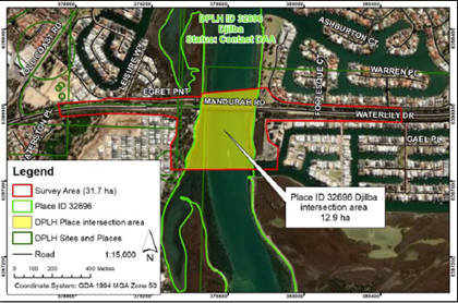
Heritage site 32696
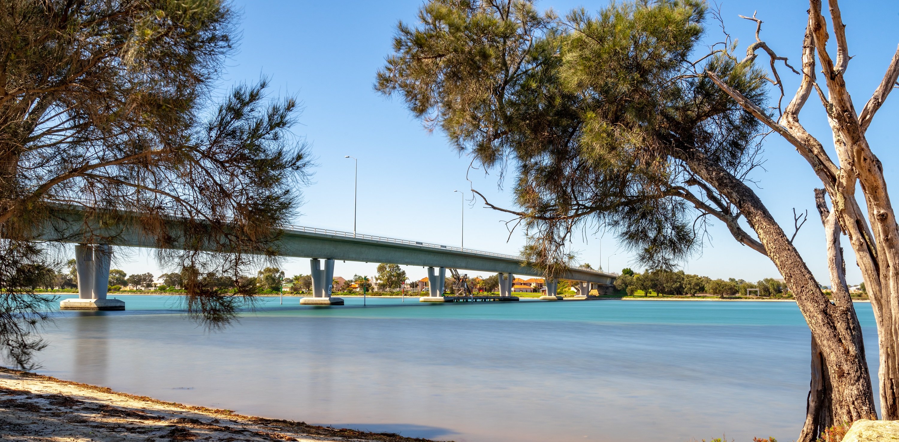
The area referred to Djilba is an Aboriginal Cultural Heritage (ACH) Registered Place with the place ID number 32696. It is an area of importance to the Bindjareb people. Djilba includes approximately 12.9ha of the Mandurah Estuary and its embankments. While there are additional sites of cultural significance sitting outside of the project area (i.e. scarred trees/burial site), there are no other significant sites within the project footprint.
Djilba is a sacred site, and one that was traditionally used as a camping ground, fishing and hunting place, food and medicine resource, recreational area, gathering place and a place along a traditional bidi (path).
The Djilba site encapsulates the Peel Inlet, Harvey Estuary and Mandurah Estuary along the actual waterways and their embankments.
Djilba creation story
The 2022 Aboriginal Heritage Survey Report for Mandurah Estuary Bridge reported Place ID 32696 Djilba to be a mythological site in association with the Waugal who was reported to have created the Peel Harvey Estuary, where she gave birth to her young, who then went on to create the Murray, Harvey and Serpentine Rivers (Yates & Walley 2013).
Some Bindjareb people believe the mother, Waugal, created Lake Preston and Leschenault Estuary before returning to the ocean (ibid). While the entire Peel, Harvey and Mandurah waterways were reported to be a “significant and integral part of the Waugal Creation Myth”, the Mandurah Estuary was “particularly significant as the starting point of the Waugal’s creation of the region’s water system, and as the pathway of the spirits on their way out to Kuranup, where the spirits go beyond the western sea” (Yates & Goode 2009: 64).
Women’s and men’s ceremonial sites were reported to be located in the Peel Harvey Estuary, as well as it being a significant food and fresh water source (ibid).
Heritage assessment and commitment
Prior to work getting underway, a Site Identification Aboriginal Heritage Survey was completed in January 2022 with representatives from the Gnaala Karla Boodja (GKB) Indigenous Land Use Agreement (ILUA) group, as nominated by the South West Aboriginal Land and Sea Council (SWALSC), taking part.
The project has a Section 18 Approval (under the Aboriginal Heritage Act 1972 ) for works within Djilba. The project will report to the Department of Planning, Lands and Heritage, and to advise of any culturally significant findings as a result of working in the area.
Integral to the delivery of positive outcomes around Aboriginal heritage is the Bindjareb Reference Group (BRG). The group is made up of representatives from the Bindjareb community and these members share knowledge and information, provide advice and input, address concerns and enhance the outcomes of the project.
During operational work hours, local Bindjareb cultural and archaeological monitors will be present on site for to safeguard against detrimental impacts on the Mandurah Estuary and its embankments.
Heritage considerations
The project is endeavouring to meet the Gnaala Karla Boodja (GKB) Indigenous Land Use Agreement group representatives’ cultural heritage management requests.
To do this, we work with our Bindjareb Reference Group and identity opportunities to highlight and acknowledge the strong connection to this area through urban design.