What's happening
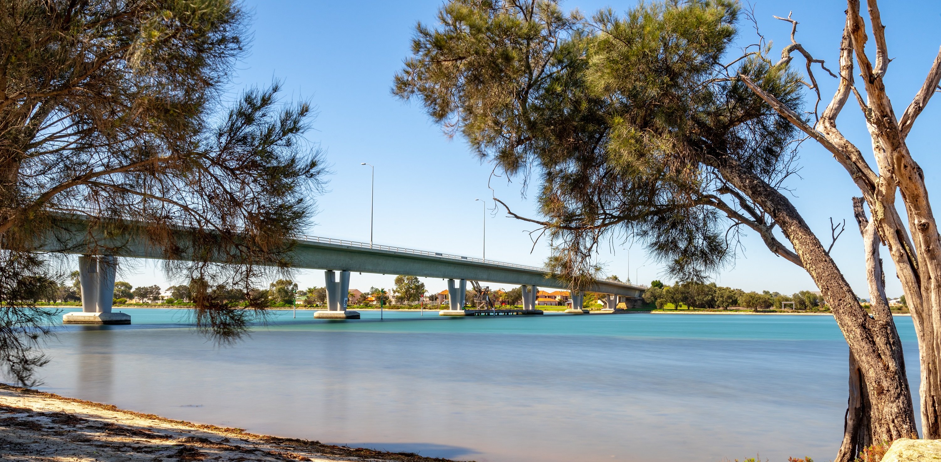
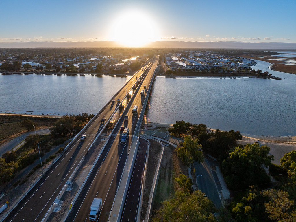
The Mandurah Estuary Bridge Duplication project has now been completed, with both bridges offering two lanes in each direction.
The completion of the new bridge and upgrade to the existing bridge will provide a safer and more efficient travel across the Mandurah Estuary for the 33,000 daily vehicles movements in both directions.
Cycling, walking and other path users from southern areas will now have their own Principal Shared Path (PSP) on the new bridge with upgrades made to the PSP on the existing bridge.
Yarning Circles have been constructed on both sides of the estuary outlining the importance of this place within Aboriginal cultural tradition, and the importance of the estuary to all people through their stories. Aboriginal themed artwork is also to be seen on bridge piers.
Coloured feature lighting has been installed on both bridges which will enhance the Mandurah skyline.
With the opening of the new bridge and the upgrade to the existing bridge, Mandurah residents and travellers are set for safer and better journeys, as another congestion point is busted.
Existing fishing platform
A new all accessible fishing platform and supporting car park has been constructed under the bridges on the eastern foreshore.
The existing fishing platform remains closed for safety reasons.
The Mandurah Estuary Bridge Duplication Project is a major infrastructure initiative by the Australian and Western Australian Governments designed to reduce congestion, improve road user safety and increase connectivity for Mandurah and the surrounding Peel Region.
Originally constructed in the 1980s with later duplication in mind, the current $148.8 million project will deliver a second two-lane bridge on the south side of the existing Mandurah Estuary Bridge with the capacity to go to three lanes in the future, supporting regional growth.
The Project also enhances the location as a recreational area, delivering an accessible fishing platform, yarning circles on both eastern and western foreshores, an improved accessible shared path network and carpark, programmable feature lighting and urban design elements.
Infrastructure sustainability is delivering infrastructure that is designed, constructed and operated to optimise long term environmental, social and economic outcomes.
The Infrastructure Sustainability Council (ISC) has been supporting the infrastructure industry to drive best practice since 2012, using the Infrastructure Sustainability rating framework to assist with assessing sustainability performance.
To support our commitment to driving positive sustainable outcomes, we are applying the Infrastructure Sustainability Council (ISC) V2.1 Infrastructure Sustainability (IS) rating framework for the design, construction and operational phases of this project. The Project’s Design and As Built sustainability objectives and targets provide details of our overall approach.
We have developed a Fact Sheet to provide an overview of the sustainability approach on this project.
Public Annual Sustainability Reports will be compiled throughout the design and construction phases of the Project.
We aim to avoid, minimise, and reduce our negative impacts to Aboriginal and European heritage sites wherever practicable, in line with Main Roads’ commitment to recognising heritage.
Heritage site 32696
The area referred to Djilba is an Aboriginal Cultural Heritage (ACH) Registered Place with the place ID number 32696. It is an area of importance to the Bindjareb people. Djilba includes approximately 12.9ha of the Mandurah Estuary and its embankments. While there are additional sites of cultural significance sitting outside of the project area (i.e. scarred trees/burial site), there are no other significant sites within the project footprint.
Djilba is a sacred site, and one that was traditionally used as a camping ground, fishing and hunting place, food and medicine resource, recreational area, gathering place and a place along a traditional bidi (path).
The Djilba site encapsulates the Peel Inlet, Harvey Estuary and Mandurah Estuary along the actual waterways and their embankments.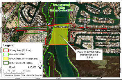
Djilba creation story
The 2022 Aboriginal Heritage Survey Report for Mandurah Estuary Bridge reported Place ID 32696 Djilba to be a mythological site in association with the Waugal who was reported to have created the Peel Harvey Estuary, where she gave birth to her young, who then went on to create the Murray, Harvey and Serpentine Rivers (Yates & Walley 2013).
Some Bindjareb people believe the mother, Waugal, created Lake Preston and Leschenault Estuary before returning to the ocean (ibid). While the entire Peel, Harvey and Mandurah waterways were reported to be a “significant and integral part of the Waugal Creation Myth”, the Mandurah Estuary was “particularly significant as the starting point of the Waugal’s creation of the region’s water system, and as the pathway of the spirits on their way out to Kuranup, where the spirits go beyond the western sea” (Yates & Goode 2009: 64).
Women’s and men’s ceremonial sites were reported to be located in the Peel Harvey Estuary, as well as it being a significant food and fresh water source (ibid).
Heritage assessment and commitment
Prior to work getting underway, a Site Identification Aboriginal Heritage Survey was completed in January 2022 with representatives from the Gnaala Karla Boodja (GKB) Indigenous Land Use Agreement (ILUA) group, as nominated by the South West Aboriginal Land and Sea Council (SWALSC), taking part.
The project has a Section 18 Approval (under the Aboriginal Heritage Act 1972 ) for works within Djilba. The project will report to the Department of Planning, Lands and Heritage, and to advise of any culturally significant findings as a result of working in the area.
Integral to the delivery of positive outcomes around Aboriginal heritage is the Bindjareb Reference Group (BRG). The group is made up of representatives from the Bindjareb community and these members share knowledge and information, provide advice and input, address concerns and enhance the outcomes of the project.
During operational work hours, local Bindjareb cultural and archaeological monitors will be present on site for to safeguard against detrimental impacts on the Mandurah Estuary and its embankments.
Heritage considerations
The project is endeavouring to meet the Gnaala Karla Boodja (GKB) Indigenous Land Use Agreement group representatives’ cultural heritage management requests.
To do this, we work with our Bindjareb Reference Group and identity opportunities to highlight and acknowledge the strong connection to this area through urban design.
Project Updates
- Project Update - May 2026 - PDF (405 KB)
- Construction Update - December 2025/January 2026 - PDF (318 KB)
- Construction Update - November 2025 - PDF (322 KB)
- Construction Update - October 2025 - PDF (340 KB)
- Construction Update - September 2025 - PDF (283 KB)
- Construction Update - August 2025 - PDF (621 KB)
- Construction Update - July 2025 - PDF (185 KB)
- Construction Update - June 2025 - PDF (246 KB)
- Project Update - May 2025 - PDF (863 KB)
- Construction Update - May 2025 - PDF (358 KB)
- Construction Update - April 2025 - PDF (302 KB)
- Construction Update - March 2025 - PDF (205 KB)
- Construction Update - Amenity Wall Clearing - PDF (345 KB)
- Construction Update - February 2025 - PDF (255 KB)
- Construction Update - December 2024 - PDF (427 KB)
- Construction Update - November 2024 - PDF (260 KB)
- Project Update - November 2024 - PDF (118 KB)
- Construction Update - October 2024 - PDF (326 KB)
- Project Update - September 2024 - PDF (3.98 MB)
- Construction Update - September 2024 - PDF (334 KB)
- Construction Update - August 2024 - PDF (313 KB)
- Construction Update - July 2024 - PDF (280 KB)
- Construction Update - June 2024 - PDF (279 KB)
- Construction Update - May 2024 - PDF (304 KB)
- Construction Update - April 2024 - PDF (217 KB)
- Construction Update - March 2024 - PDF (375 KB)
- Construction Update - February 2024 - PDF (269 KB)
- Project Update - December 2023 - PDF (345 KB)
- Project Update - November 2023 - PDF (231 KB)
- Project Update - August 2022 - PDF (2 MB)
- Project Update - May 2022 - PDF (643 KB)
Project Information
- Mandurah Estuary Bridge Community Event - YouTube
- Mandurah Estuary Bridge Feature Lighting - YouTube
- Check out the duplicated Mandurah Estuary Bridge - YouTube
- Opening of the new bridge - YouTube
- Timelapse Video - February 2024 to April 2025 - YouTube
- Project Map - Additional Walls - PDF (194 KB)
Fact Sheets/FAQs
- Fact Sheet - Urban Design Elements - May 2025 - PDF (582 KB)
- Frequently Asked Questions - November 2024 - PDF (445 KB)
- Fact Sheet - Noise Wall - November 2024 - PDF (288 KB)
- Frequently Asked Questions - Casting yard - May 2024 - PDF (264 KB)
- Fact Sheet - Launching the bridge - May 2024 - PDF (536 KB)
- Vibrations - Fact Sheet - March 2024 - PDF (539 KB)
- Dust Management - Fact Sheet - February 2024 - PDF (595 KB)
- Frequently Asked Questions - April 2024 - PDF (410 KB)
Media Statement
- Mandurah congestion-busting project launches into new milestone - 18 November 2024
- Joint media statement - Work starts on Mandurah Estuary Bridge Duplication - 19 January 2024
- Joint media statement - Major milestone for Mandurah Estuary Bridge duplication - 29 September 2023
- Expression of Interest called for Mandurah Estuary Bridge Duplication project - 14 July 2022
- McGowan Government to duplicate Mandurah Estuary Bridge - 10 September 2021
Community
- MySay Transport Survey 2023 Results - PDF (209 KB)
Funding
The Mandurah Estuary Bridge Duplication Project is jointly funded by the Australian ($68 million) and Western Australian Governments ($80.8 million).
The Mandurah Estuary Bridge Duplication Project is jointly funded by the Australian and Western Australian Governments, with each contributing $68 million.McGowan Government to duplicate Mandurah Estuary Bridge
connectivity & safety
traffic flow