What's Happening
Watch the project construction of this beautiful bridge from start to finish!
This timelapse captures early works right through to the community opening on 22 December 2024. Since then, it’s been used by thousands of people every day, better connecting Western Australians to the city and surrounds.
From sunset and midnight daily, the bridge lighting creates a breathtaking visual experience you won’t want to miss. Enjoy the stunning lighting created with over 17,000 LED lights from the vantage points identified here.
To find out details of this week’s lighting program, please visit our lighting page here.
The design of the bridge resulted from consultation with key stakeholders including local governments, Traditional Owners, specialist groups, cycling and boating authorities and other government agencies, taking into consideration path user requirements, local developments on either side of the bridges, future maritime height allowances and the needs of existing river users.
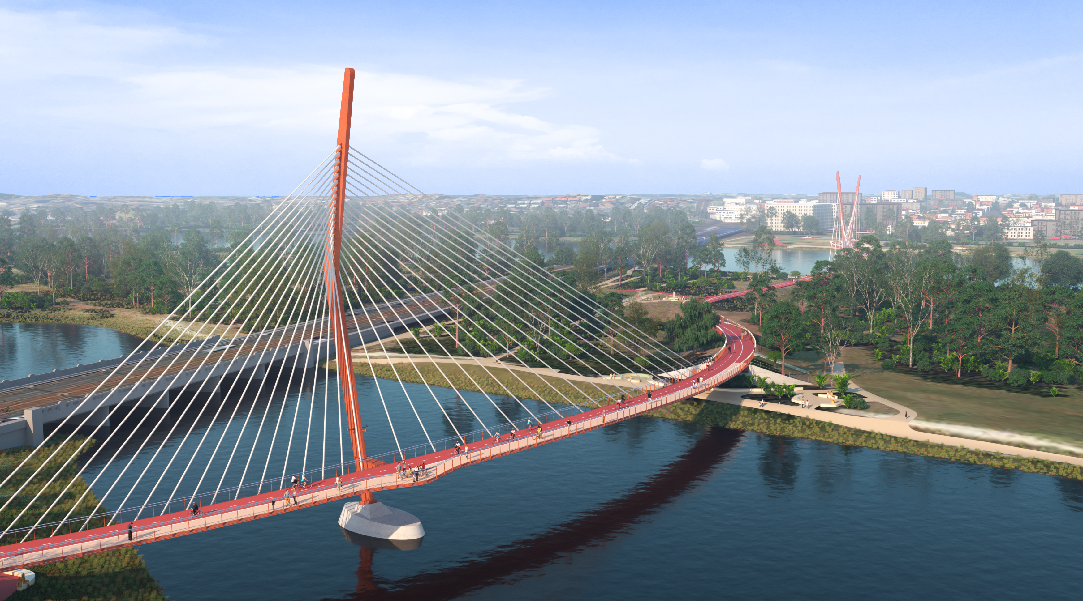
Built as two bridges that connect over Heirisson Island, the s-shaped curves of the bridge’s design represents the sinuous movement of the Wagyl (rainbow serpent), while supporting the increased clearance heights above the river and minimising the number of trees impacted by construction.
Key to this design is minimising impacts to the sacred Swan River (Derbarl Yerrigan). The cable-stay design ensures less impact to the river, with only three permanent pylon required to support both bridges.
The location, approximately 90 metres downstream of the existing Causeway traffic bridge, was chosen as it minimises impacts on flora and fauna, while improving path user connections and amenity.
Integral to the design are references to prominent Whadjuk Noongar people, including: Yagan, a warrior and young leader, represented by a boomerang-inspired pylon, and Balbuk who fought to retain the Swan-Coastal Plain’s over-development and is represented by two digging stick-inspired pylons.
Two of the three pylons are inspired by the shape of wannas, or digging sticks. The wanna is a tool used for harvesting edible roots, particularly the yangeti, which grew around Matagarup and the wetlands and lakes. The wannas symbolise Balbuk, a woman who fought to maintain her rights to Country in the face of development.“When a house was built in the way, she broke its fence-palings with her wanna and charged up the steps and through the rooms…”
One of the three pylons is inspired by the shape of the koylie the boomerang. This is a tool used for hunting game, and is thrown hard and low to the ground. The koylie symbolises Yagan, a strong, young Whadjuk warrior, who was one of the leaders in resisting colonisation from 1829, until he was killed in 1833.
During construction, the northern channel, which is used by recreational and commercial vessels, will remain open with spotter vessels escorting river users through the work zone to manage the flow of river traffic during construction. On occasion, this will involve the passage of river traffic being paused for a short time. The two spotter vessels will be located north and south of the work zone and all river users will be guided by the direction of a spotter vessel through the work zone. River users will be able to communicate with the spotter vessels via VHF 07.
Records from the Department of Transport for the past two years indicate an average of 25 vessels pass through this channel daily. The current speed limit of 5 knots will be maintained for river users in the northern channel during river works.
Construction on land will involve ground preparation, piling (setting deep foundations for bridge abutments) and earthworks for the bridge approach embankments.
In-river works will include piling, pile caps and constructing pylon structures. The two ‘lay down areas’ will be at the Point Fraser and McCallum Park foreshores near to where the bridge lands.
Works will be conducted to minimise any impact to community, foreshore park users and river vessels. Advanced notice of impacts will be provided on the project website and to those directly affected.
The bridges will be fabricated steel decks made from weathering steel, which provides a “rusty” appearance, with no painting required. Construction will start from McCallum Park, and work towards Heirisson Island, and then onto Point Fraser.
The first step will involve constructing a temporary loadout facility (jetty) from the Project’s McCallum Park site, which will be used to transport equipment and materials onto vessels and barges. Next, there will be piling in the river. Six piles are required for each of the three pylons (the two digging sticks and boomerang).
In addition, temporary piles will be installed as temporary supports for bridge structures. Next the bridge deck and pylons will be installed. The deck will be installed in 22 to 42m segments, which will be transported to the site by road from the Civmec workshop at Henderson. Each segment will be lifted into place by a crane. The final step will be to connect the cables to the bridge and pylons.
The primary mechanism for communicating with all river users, inclusive of commercial vessels, will be through the Department of Transport’s Notice to Mariners which is available here.
If you have any questions, please contact 138 138 or email enquiries@mainroads.wa.gov.au
For the safety of the public and construction workers, an exclusion boundary will be in place across the southern channel for the duration of works. This is not a gazetted navigational channel and only power boats and water sports vessels are usually allowed access. We have been engaging extensively with the WA Water Sports Association regarding this closure.
Two cable stayed bridges will be constructed, approximately 90 metres downstream of the existing Causeway Bridge, comprising a six metre wide segregated path, connecting Victoria Park foreshore, Heirisson Island and Perth’s CBD at Point Fraser. There will be dedicated rest points along the bridges, which are being built for path users, not vehicles.
The innovative design has been developed in consultation with key stakeholders including local governments, Traditional Owners and specialist groups, taking into consideration path user requirements, local developments on either side of the bridges, future maritime height allowances and the needs of river users. The design will reflect and embed Whadjuk Noongar culture, recognising the significance of Aboriginal heritage at Heirisson Island and the Swan River.
The scope also includes a number of enabling activities and activation works for the Causeway Pedestrian and Cyclist Bridges project. These include:
- Temporary works to facilitate the bridges construction, including the realignment of Riverside Drive and the Principal Shared Path (PSP) connections.
- The replacement of a near 100-year-old water main on a new alignment.
- Temporary river works to facilitate construction and boating navigation during the construction period.
- Enhanced landscaping and design elements to meet City of Perth and the Town of Victoria Park aspirations for the new bridges.
- Inclusion of Aboriginal sculptures and installations to recognise and respect the importance of the area to the Whadjuk Noongar people and also to educate and celebrate the Aboriginal history of the surrounding area.
- Enhanced lighting to maximise the opportunity the unique design offers to create a landmark, a sense of place and promote Perth at both a domestic and international level.
In April 2022, a contract was awarded to Causeway Link Alliance, comprising Civmec Construction and Engineering Pty Ltd, Seymour Whyte Constructions Pty Ltd, WSP Australia Pty Ltd and Main Roads WA, to design and construct this iconic project.
Check out the video below for more information.
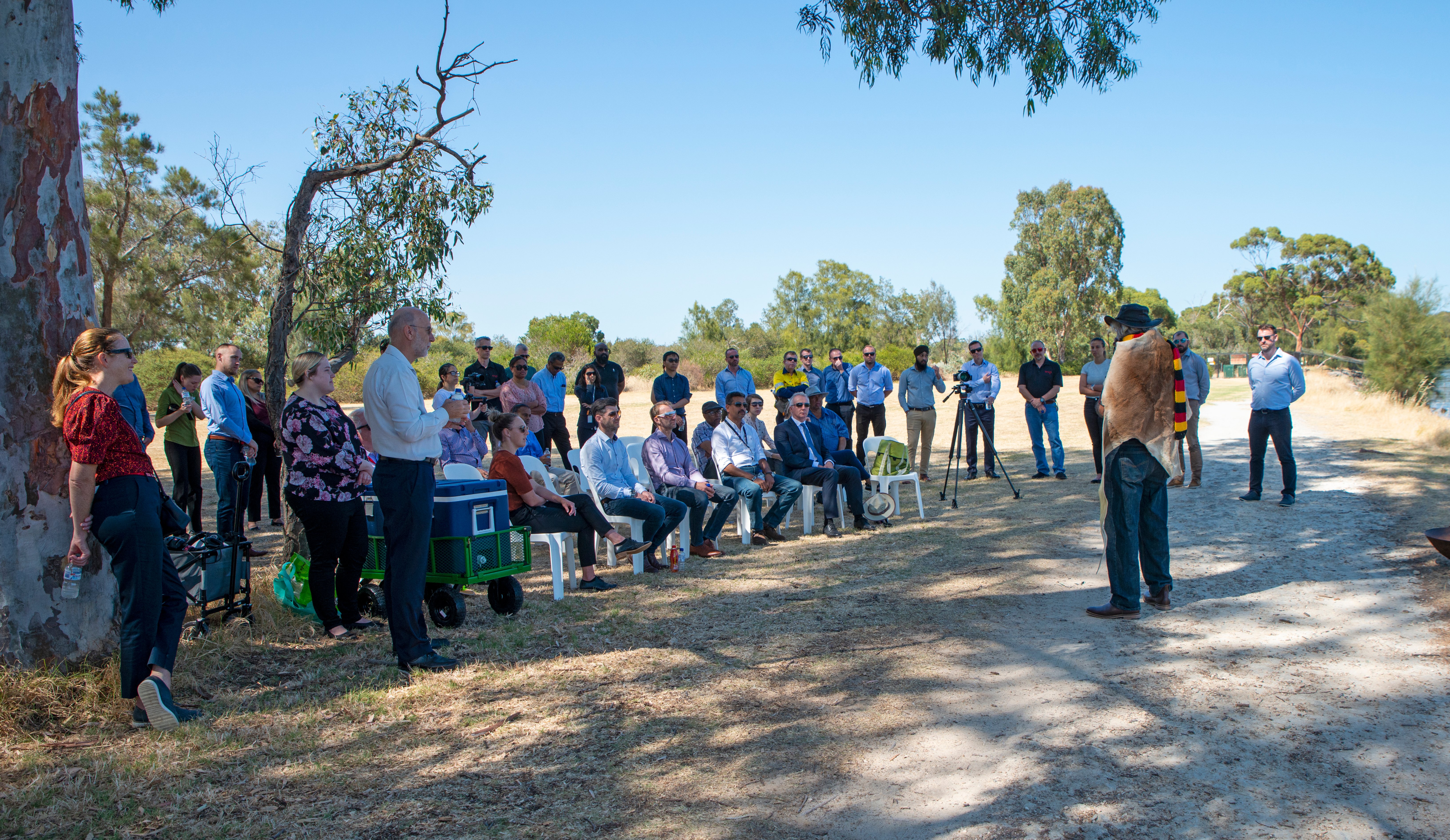
We recognise that this site holds strong cultural significance to Aboriginal people. We acknowledge the importance of ensuring the cultural heritage values of the area are respected, protected and celebrated. As such, we expect extensive, ongoing engagement with local Traditional Custodians and Noongar community members.
We hosted the inaugural Aboriginal Elders advisory group meeting in September 2021 and have held many further meetings to date. The group’s name, Matagarup Elders Group (MEG), was decided by its members and is symbolic of the project footprint on the Swan River near Heirisson Island, which Aboriginal people refer to as “matagarup”, meaning “a place where the river is only leg deep” (also known as “muddy knees”).
The MEG will provide valuable cultural input and inform the design of the bridges and the pathway. Traditionally, the site of this project had specific areas for “women’s” and “men’s” business, therefore the MEG consists of eighteen members, with equal male and female representation for each of the families recognised as having cultural connection to the area.
As part of the development of tender proposals, members of the MEG were involved in interactive workshops with the proponents to ensure their input to design was captured meaningfully and appropriately.
By acknowledging the deep cultural significance and connection to the land, and involving Matagarup Elders throughout the planning, design and construction of this project, we strive to ensure that together, we will deliver an iconic, culturally-sensitive legacy project that all stakeholders and community members can connect to with a sense of shared ownership and immense satisfaction.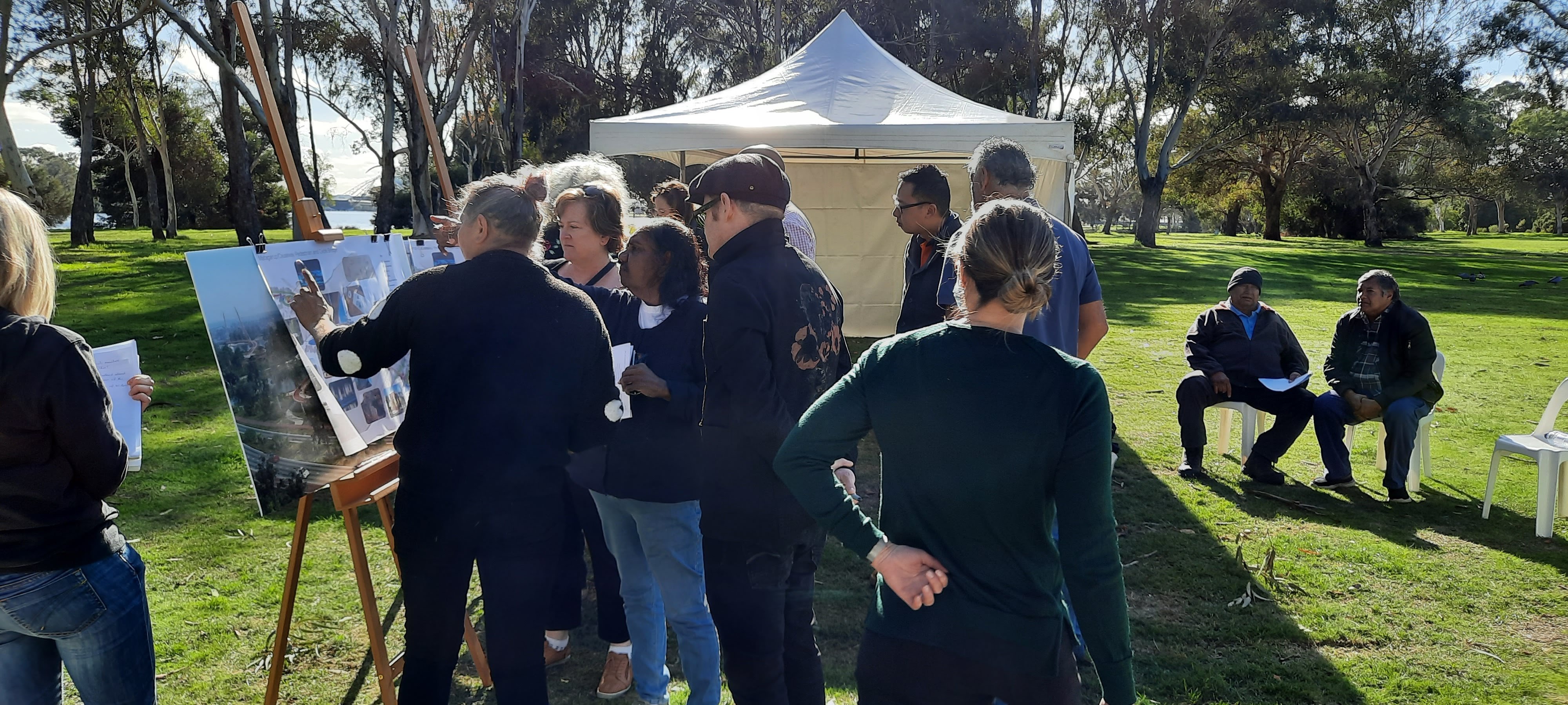
We acknowledge that the Swan River and Heirisson Island are very significant to the Traditional Custodians of the area and the wider Perth community.
Whilst the bridges and connecting path alignment has been designed to minimise the impacts and removal of trees, some vegetation clearing will be required on Heirisson Island and at Point Fraser. These clearing works will commence in early 2023.
We will be using bridge construction techniques that minimise impacts on the surrounding environment, including the marine, bird and land animals. The kangaroos that currently live on Heirisson Island will remain.
A Construction Environmental Management Plan (CEMP) that defines the minimum management requirements during construction will be developed in consultation with key stakeholders and once all environmental surveys are complete.
We want to hear from you
We value your feedback - The Causeway Link Alliance invites all stakeholders and community members to complete a survey to let us know how effective our communications are and how we can best communicate with you on this project. The survey should take no more than five minutes.
Project Updates
- Project Update - April 2025 - PDF (685 KB)
- Project Update - December 2024 - PDF (408 KB)
- Project Update - October 2024 - PDF (1.17 MB)
- Project Update - July 2024 - PDF (627 KB)
- Project Update - April 2024 - PDF (613 KB)
- Construction Fact Sheet - February 2024 - (PDF 839 KB)
- Project Update - December 2023 - PDF (851 KB)
- Project Update - October 2023 - PDF (884 KB)
- Project Update - June 2023 - PDF - (916 KB)
- Project Update - April 2023 - PDF (363 KB)
- Construction Update - March 2023 - Heirisson Island - PDF (503 KB)
- Project Update - February 2023 - PDF (865 KB)
- Project Update - December 2022 - PDF (305 KB)
Project Information
- Path Users Fact Sheet - December 2024 - PDF (387 KB)
- Lighting Fact Sheet - December 2024 - PDF (355 KB)
- Lighting Display Map - PDF (394 KB)
- Frequently Asked Questions - October 2024 - PDF (280 KB)
- Creating a Great Place - Fact Sheet - PDF (512 KB)
- Public Art Fact Sheet - August 2024 - PDF (11.65 MB)
- Next Steps to Bridge Completion - May to December 2024 - PDF (1.52 MB)
- Aboriginal Cultural Heritage Fact Sheet - April 23 - PDF (56.7 MB)
- Environment Fact Sheet - April 2023 - PDF (705 KB)
Media Statements
- Joint media statement - BOORLOO BRIDGE NOW OPEN FOR PEDESTRIANS AND CYCLISTS - 22 December 2024
- Free Twilight Community Event to celebrate the opening of Boorloo Bridge - 10 December 2024
- Joint media statement - Causeway pedestrian bridges set for December opening - 14 November 2024
- Joint Media Statement - Causeway bridges crossing now in place - 4 August 2024
- Perth’s $100m Causeway pedestrian/cyclist bridges project wins Cycling Luminaries Award in Canberra - WestCycle - 17 November 2023
- Joint media statement - Construction starts on new gateway to city - 1 March 2023
- Major boost for the Perth City Deal - 17 March 2022
- Proponents shortlisted for iconic new Swan River Causeway Bridge - 28 April 2021
- Expressions of interest now open to build iconic new Causeway Bridge - 29 January 2021
- New Swan River bridge to be built as part of WA Recovery - 26 August 2020
- Building for Tomorrow program a key feature of economic recovery - 23 August 2020
Funding
Funding has been allocated as part of the Perth City Deal, jointly funded by the Australian and Western Australian governments. The allocation for the bridge component is $105.9 million, with further funding provided for enabling and activation works, including enhanced lighting and landscaping elements, and replacement of water mains.
Concept only - Subject to change
safety, connectivity & amenity
conflicts between cyclists & pedestrians