


What's happening
Early works continues
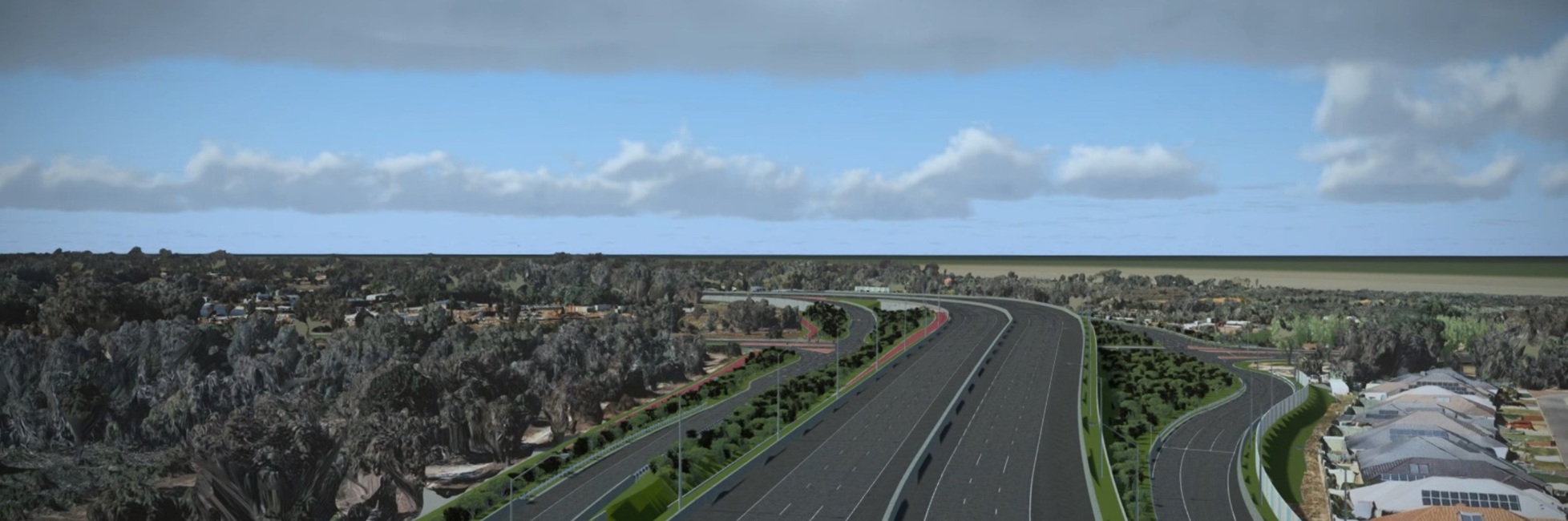
Early works are continuing for the next stage of the Tonkin Highway Corridor upgrade between Roe Highway and south of Welshpool Road.
Site establishment works
From Monday, 21 September to Friday 27 November 2026, activities will include project signage installation, and a site compound and laydown area will be established on Hardey East Road, Wattle Grove.
During this period, activities such as potholing, geotechnical investigations and pavement sampling as well as groundwater monitoring, preliminary fencing and bore drilling works.
To complete the works safely while minimising impacts to road users, intermittent temporary traffic changes will be in place, including:
- Short-term single-lane closures, verge works and reduced speed limits on Hale Road and Welshpool Road East
- Limited nighttime lane closures on Tonkin Highway
- Daytime verge works and reduced speed limits on Hale Road and Welshpool Road East
- Increased construction vehicle movements, lighting and intermittent noise on Hardey East Road.
Works will also take place near pedestrian and cycling paths. Where required, personnel will be available to assist pedestrians and cyclists safely past the work area.
Road users should allow additional travel time, follow traffic signs and directions, and take care when travelling through the area.
The timing of the works may change due to weather conditions, operational requirements or workforce availability.
Western Power Works
Western Power has completed the installation of new transmission poles and the relocation of overhead power infrastructure along Hale Road as part of preparations for the corridor upgrade.
Kelvin Road Interchange
EPBC 2022/09325
Notification for Publication of Preliminary Documentation under the Environment and Biodiversity Conservation Act 1999 (EPBC Act)
Invitation for Public Comment
In accordance with Section 95A(3) of the EPBC Act, public comment is invited on an action proposed to be taken in the City of Gosnells and the City of Kalamunda, Western Australia.
Main Roads Western Australia is proposing to upgrade and widen a 2 km section of Tonkin Highway from approximately 1 km north of Kelvin Road to Maddington Road in the south (the Proposed Action). The Proposed Action includes the construction of a new grade separated interchange at Kelvin Road, construction of additional lanes in each direction, installation of a principal shared path and other associated road infrastructure.
The Proposed Action has been determined to be a controlled action under the EPBC Act and will be assessed through Preliminary Documentation. The controlling provision under Part 3 of the EPBC Act is listed threatened species and communities (Section 18 and 18A). The EPBC-listed species and communities (protected matters) that are impacted by the Proposed Action include:
- Baudin’s Black Cockatoo (Zanda baudinii) – Endangered
- Forest Red-tailed Black Cockatoo (Calyptorhynchus banksii naso) – Vulnerable
- Carnaby’s Black Cockatoo (Zanda latirostris) – Endangered
- Banksia Woodlands of the Swan Coastal Plain threatened ecological community – Endangered
- Vegetation potentially representative of the Corymbia calophylla - Kingia australis woodlands on heavy soils of the Swan Coastal Plain threatened ecological community – Endangered
- Corymbia calophylla - Xanthorrhoea preissii woodlands and shrublands of the Swan Coastal Plain threatened ecological community – Endangered
- Wavy-leaved Smokebush (Conospermum undulatum) – Vulnerable
- Southern Tetraria (Morelotia australiensis) – Vulnerable.
In accordance with Section 95A(3) of the EPBC Act, Preliminary Documentation related to the Proposed Action is available for viewing and comment for 20 business days from 5 October to 30 October 2026.
Electronic versions of the documentation can be viewed or downloaded in portable document format (PDF) below.
EPBC Preliminary Documentation
- TGSI Kelvin Road - EPBC 2022/09325 - Preliminary Documentation
- Appendix A Further Information required for PD
- Appendix B Concept Design Layout
- Appendix C1 MCA Selection Report (Arup, 2023)
- Appendix C2 MCA Selection Report Addendum (Arup, 2023)
- Appendix D1 Biological and BC Assessment (Woodman, 2021)
- Appendix D2 Dieback Occurrence Assessment (Glevan, 2020)
- Appendix D3 Extended Spring Survey (GHD 2021a)
- Appendix D4 Clifford Street Bushland FCT Analysis (GHD 2021b)
- Appendix D5 Morelotia australiensis Strategic Habitat Assessment (Woodman, 2021)
- Appendix D6 FCT Analysis of TGSI Floristic Data (Umwelt, 2022)
- Appendix D7 FCT Analysis of TGSI Floristic Data addendum (Umwelt, 2023)
- Appendix D8 Threatened Flora Survey (Umwelt, 2024)
- Appendix D9 Threatened Flora Survey (Umwelt, 2025)
- Appendix E Action Management Plan
- Appendix F Australian Black Cockatoo Specialist Advice
- Appendix G Offset Strategy
- Supplementary Information - Responses to NEPA questions (24 August 2026)
EPBC Referral information
- TGSI Kelvin Road - EPBC 2022/09325 – Referral
- Appendix 1 - Biological Survey and Targeted Black Cockatoo Habitat Assessment (Woodman Environmental, 2021)
- Appendix 2 - TGSI (Roe Hwy to Kelvin Road), Extended Spring Survey (GHD, 2021a)
- Appendix 3 - TGSI Clifford Street Bush Forever Site FCT Analysis (GHD, 2021b)
- Appendix 4 - TGSI TEC Significant Ecological Community Site Visit (GHD, 2021c)
- Attachment 1 -TGSI Kelvin Road EPBC Referral Supporting Document
- Attachment 3 - Stakeholder Consultation
- Attachment 4 - Land Tenure (lot and deposited plan)
- Attachment 5 - Vegetation Types and Condition
- Attachment 6 - Avoidance and Mitigation Measures
- Attachment 7- Alternative Options
Hard copies of the Referral and Preliminary Documentation (including all attachments) will also be available to view for a period of 20 business days from 5 October to 30 October 2026 at the following locations:
- State Library of Western Australia
25 Francis Street, Perth WA 6000 - Gosnells Public Library
The Agonis
2232D Albany Highway, Gosnells WA 6110 - Lesmurdie Library
Lesmurdie Senior High School Campus
21 Reid Road, Lesmurdie WA 6076
Hard copies of the documentation may be purchased for $10 (including postage and packaging):
Company Name Office of Major Transport Infrastructure Delivery
Address 34 Stirling Street, Perth WA 6000
Telephone No. 138 138
Comments are to be received before 30 October 2026 and addressed to:
Should assistance be required to access the documents (i.e., for persons for whom English is a second language or who have a vision impairment), please email enquiries@mainroads.wa.gov.au or contact Main Roads’ Customer Information Centre on 138 138.
Roe Highway to south of Welshpool Road project
Environmental assessment
The project has been subject to detailed environmental investigations and approvals processes at both State and Commonwealth Government levels.
Environmental surveys have been undertaken between 2015 and 2024 to inform project design and mitigation measures. These surveys considered vegetation, threatened flora and fauna, wetlands, groundwater and surface water systems.
The Hale Road and Welshpool Road East stage has received State and Federal environmental approval, subject to conditions. Further environmental assessment and approvals are required before the proposed Kelvin Road interchange can proceed.
Environmental management
The project includes measures to avoid, minimise and manage environmental impacts, including:
- Refinement of the project footprint to reduce clearing where possible.
- Protection of threatened ecological communities and conservation areas.
- Management of impacts to registered Aboriginal heritage sites.
- Ongoing surface water and groundwater monitoring.
- Landscaping and revegetation following construction.
Main Roads will continue to engage with local environmental groups and relevant government agencies throughout project delivery.
Vegetation clearing
Some vegetation clearing is required to deliver the interchanges, highway widening and associated utility relocations. All clearing is undertaken in accordance with environmental approvals and conditions, with monitoring and management measures in place.
Environmental documentation
Environmental referral documents, approval conditions and supporting technical reports are available via the Construction Project Compliance Reports page.
safety
journeys
connectivity