What's Happening
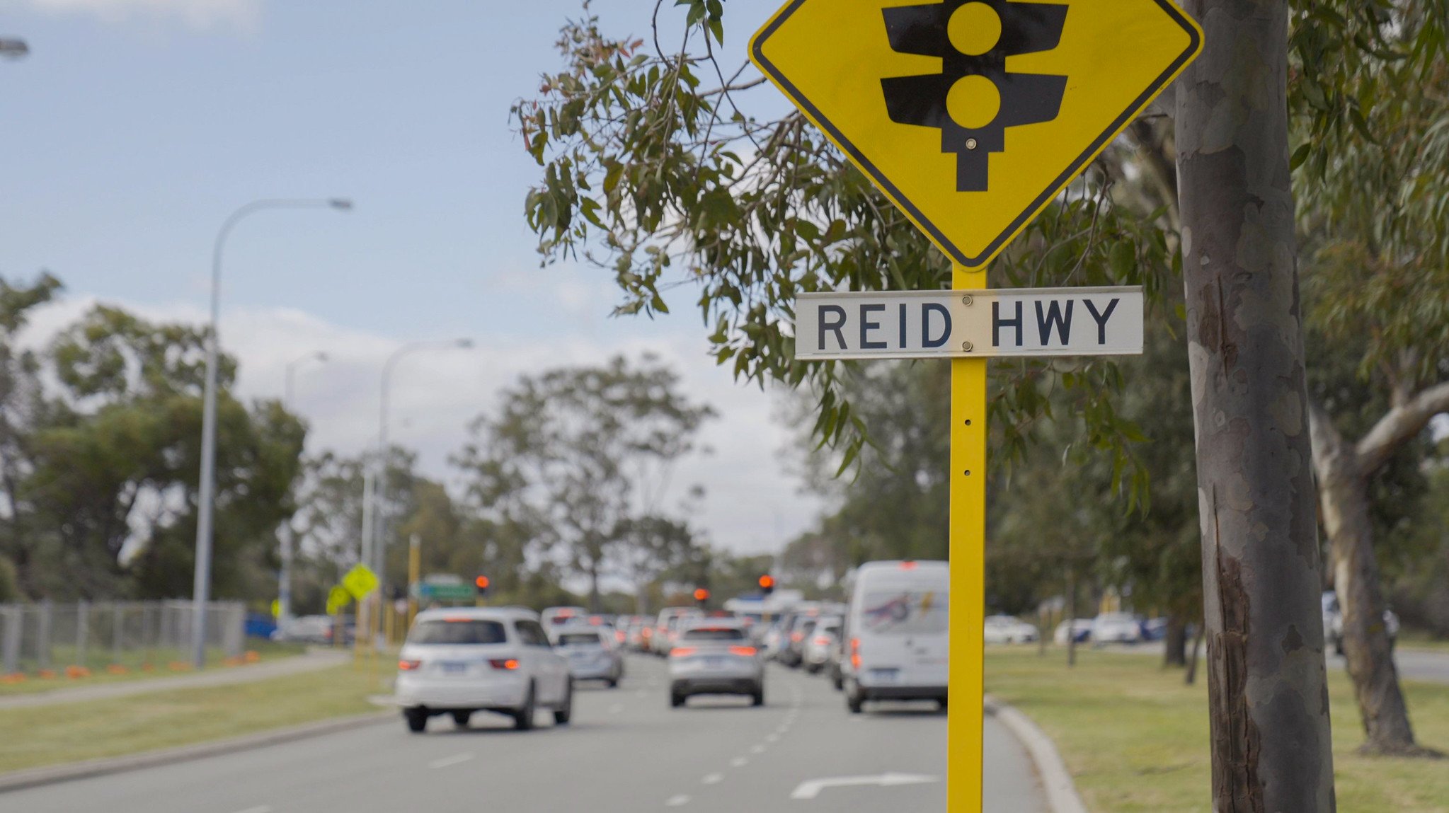
Planning has commenced to transform the Reid Highway and Erindale Road intersection into a grade-separated interchange.
A preliminary concept has been developed for a grade separated interchange at Reid Highway and Erindale Road as part of the project’s early planning and development.
View the updated Preliminary Concept Plan here.
The preliminary concept includes:
- A bridge carrying Erindale Road over Reid Highway
- Loop ramps in the northeastern and southeastern quadrants for full connectivity
- A new free-flow southbound ramp from Reid Highway westbound to Mitchell Freeway southbound, with ramp signals
- Upgrades to the signalised intersection at Erindale Road and Balcatta Road to accommodate the increased traffic into the Balcatta industrial precinct.
- Modifications to the Reid Highway and Balcatta Road intersection from the Mitchell Freeway southbound exit ramp
- Upgrades to the Principal Shared Path (PSP) along Reid Highway including new underpasses and overpasses providing improved connections to the PSP on the eastern side of the Mitchell Freeway
Balcatta Road/Reid Highway intersection closure
To support this upgrade, the section of Balcatta Road from Balcatta Road/Reid Highway intersection to Ledgar Road will be removed to make way for the new ramp from Reid Highway westbound onto Mitchell Freeway Southbound. This long‑planned change is essential to deliver the full benefits of the grade separation, improving safety, traffic flow and network reliability. It also supports future traffic demand and efficient access to and from the Balcatta industrial area, Reid Highway and the freeway. For more information, please visit the FAQs section below.
Please note that these features are subject to change as additional site investigations and analyses are undertaken to inform design development.
Extensive development works including various design investigations, site assessments and traffic modelling are underway to refine the scope and progress the required statutory approvals to allow for road construction to commence in late 2028 (subject to statutory approvals).
Community Survey
In April and May 2026, we asked the local community and road users to share their experiences using the Reid Highway and Erindale Road intersection.
A total of 443 people responded to the MySay Transport online survey.
Thank you to everyone who took part. For more information in the survey see our What We Heard fact sheet.
Balcatta Road Closure - west end
Why is the Balcatta Road west end being closed?
The Balcatta west end from Ledgar Road to the Mitchell Freeway/Reid Highway interchange will be closed to make way for a new on ramp onto Mitchell Freeway southbound from Reid Highway westbound.
Once the project is complete, Balcatta Road will only extend west as far as Ledgar Road.
The wider project also includes upgrades at the Erindale Road/Balcatta Road signalised intersection to support access to and from the Balcatta industrial area.
Why can't the existing Balcatta Road connection be kept by going over or under the new ramp?
Although the long-term planning for the Mitchell Freeway/Reid Highway interchange did not include the Balcatta Road connection, as part of this project Main Roads has investigated options to retain Balcatta Road connection with an overpass or underpass. However, this would result in the road having steep gradients unsuitable for heavy vehicles and substantial impacts to surrounding properties and driveways. It would also not deliver the same level of overall project benefits.
Will closing this intersection make traffic worse at Balcatta Road and Erindale Road intersection?
The project aims to improve overall traffic flow and safety.
The project includes capacity improvements at the Erindale Road and Balcatta Road intersection that are designed to reduce delays, improve signal operation and provide better access for local trips to and from Balcatta and nearby suburbs.
What will this mean for trips to and from the Balcatta industrial area?
Access to the north-west section of the Balcatta industrial area will be via the new Reid Highway/Erindale Road interchange and an improved Balcatta Road and Erindale Road intersection. If you are travelling from:
- Reid Highway - use the new interchange, then continue via the improved intersection at Balcatta Road and Erindale Road.
- Mitchell Freeway - continue to Reid Highway eastbound, then use the new interchange and access the area via the improved intersection at Balcatta Road and Erindale Road.
What impacts during construction can we expect?
Access to existing businesses and residential properties will be maintained throughout the construction period, although some changes and interruption to traffic flow are expected as with any other major road project of this nature.
As the project progresses, the community and affected businesses will be updated about expected roadworks, construction staging, access arrangements and any other impacts in advance where possible.
Will service relocations affect my business?
Significant service relocations, particularly regarding power, water and gas, are expected to enable construction. We are working closely with all impacted utility providers to carefully plan these service relocations and minimise impacts on businesses and the community. Any required service relocations or planned outages will be communicated well in advance, and service providers will advise affected properties directly about specific timing and arrangements.
How can i prepare for the project and stay informed?
You can stay informed by signing up for email updates.
Businesses may also wish to review their delivery routes, customer and staff access arrangements ahead of any future works.
General FAQs
Why is the project needed?
- Reid Highway is a key east-west arterial road in Perth’s northern suburbs, linking two major north-south corridors: Mitchell Freeway to the west and Tonkin Highway to the east, and supporting efficient connectivity to Perth Airport.
- The intersection carries approximately 83,000 vehicles per day and was ranked the most congested intersection in WA in 2023/24. It also recorded the highest number of reported crashes in the Perth metropolitan area.
- We need to improve safety and traffic flows at this intersection given the crashes and delays experienced, which impact all road users, residents, public transport, freight traffic and businesses.
- Recent investments have focused on upgrading Reid Highway by progressively replacing at-grade signalised intersections with interchanges that enable free-flowing traffic.
- The Reid Highway / Erindale Road intersection is the last remaining at-grade intersection between Mitchell Freeway and Tonkin Highway. It plays a vital role in the broader road network, facilitating access to residential suburbs such as Hamersley and Warwick, as well as the Balcatta light industrial area.
What are the key features of the project?
Key features include (subject to change as site investigations progress):
- Replacing the existing Reid Highway and Erindale Road signalised intersection with a grade-separated interchange, retaining of all current traffic movements between Reid Highway and Erindale Road
- The new interchange will include a bridge carrying Erindale Road over Reid Highway, with partial cloverleaf interchange loop ramps in the north-eastern and south-eastern quadrants (similar to Tonkin Highway/Guildford Road or Tonkin Highway/Albany Highway)
- A new free-flow southbound ramp with ramp signals to connect Reid Highway (westbound) to Mitchell Freeway (southbound).
- Upgrades to the Erindale Road and Balcatta Road signalised intersection to improve current and future traffic flows into the Balcatta industrial precinct.
- Modifications to the Reid Highway and Balcatta Road intersection Including removal of the Balcatta Road west end from Ledgar Road to make way for the new southbound ramp
- Principal Shared Path (PSP) upgrades along Reid Highway including new underpasses and overpasses providing improved connections to the PSP on the eastern side of the Mitchell Freeway.
Why is Reid Highway travelling under Erindale Road, instead of over?
- The land surface (topography) in the area favours Reid Highway going under Erindale Road.
- If Reid Highway was to travel over Erindale Road, the highway would be higher than the adjacent residential properties, causing major noise and visual impacts for property owners.
- If Erindale Road was to travel under Reid Highway, access to the existing businesses and other properties in the area would be greatly impacted.
What stage is the project in?
The project is currently in the planning and development phase. This phase involves various design investigations, site assessments and traffic modelling to confirm scope and progressing the required statutory approvals to allow for construction to commence in 2028.
What is being planned for cyclists and pedestrians?
Upgrades to the Principal Shared Path (PSP) along Reid Highway including new underpasses and overpasses providing improved connections to the PSP on the eastern side of the Mitchell Freeway.
What will it mean to my daily journeys?
The project will remove the current congestion hotspot and safety concerns at Reid Highway and Erindale Road signalised intersection. You will spend less time in traffic on Reid Highway and adjoining local roads, resulting in quicker, safer and more efficient travel times.
The project is expected to significantly improve the daily commutes for residents in Balcatta, Hamersley, Warwick, and other northern and eastern suburbs, by easing congestion and delivering safer, more efficient roads.
What are the benefits of the project?
The project will:
- Improve safety at the intersection of Reid Highway and Erindale Road.
- Reduce congestion and improve travel times along both Reid Highway and Erindale Road due to Reid travelling under Erindale.
- Improve freight travel time reliability and productivity, particularly access to and from the Balcatta industrial area.
- Improve accessibility and connectivity between Reid Highway, Mitchell Freeway, and Erindale Road.
- Upgrade the Principal Shared Path network, improving safety and connectivity for active transport users including, pedestrians and cyclists.
Who is funding the project?
The $450 million project is jointly funded (50% each) by the State and Federal Governments.
What would happen to the network if the project was not built?
Traffic is increasing each year, so if the project was not built:
- Congestion and serious (high severity) crashes would increase.
- Travel times for all road users would continue to increase.
- Travel efficiency would continue to decline for businesses in the Balcatta Industrial Area.
- Reliability of public transport would be impacted with increased travel time for PTA bus services to/from Warwick Rail Station.
- Active transport facilities—such as pedestrian and cyclist crossing points—would remain at grade. This would place additional pressure on an already congested road network, while safety outcomes for active transport users would remain unchanged.
Will you improve the surrounding areas?
Vehicles avoid congested areas and seek alternative routes, including local roads, which impacts the amenity of the surrounding area.
Safer and faster access to the road network and the Balcatta Industrial area will ensure regional travel users are on regional roads rather than local roads.
People walking and cycling will have new and improved shared path infrastructure to encourage active transport as a safe and viable alternative travel mode with effective north south and east west links.
Importantly, development of a Project Urban Design Framework, with the City of Stirling, is underway to guide the development of the project and ensure it retains a sense of place for the local community.
How will the environment be impacted?
Main Roads is committed to reducing environmental impacts during planning, construction, and maintenance of road projects. We are undertaking studies and field assessments to understand environmental values within the proposed project extent to inform the design, mitigation strategies and regulatory approvals.
The following State and Federal Environmental Approvals are required for the project:
- Federal: Main Roads referred the project to the Commonwealth Department of Climate Change, Energy, the Environment and Water (DCCEEW) in April 2026 and following public comment, DCCEEW has determined the proposal to be a “controlled action” via Preliminary Documentation. The determination can be viewed in DCCEEW’s Portal.
- State: Referral to the Environmental Protection Authority (EPA) for assessment.
Will Main Roads be acquiring land?
Some minimal private land acquisition will be required, primarily along Erindale Rd through Balcatta. We will meet with any potentially impacted landowners in coming months.
How can I have my say?
The community can provide feedback at any time by contacting us on 138 138 or enquiries@mainroads.wa.gov.au.
Will Reid Highway move closer to houses?
Yes, however, the highway lanes will still remain within the available road reserve.
When will the project be built?
Planning and development work is expected to be complete in 2027/28.
Detailed design and construction are scheduled to commence late 2028 (subject to statutory approvals).
Will noise walls be built?
Baseline noise monitoring and noise modelling have been undertaken. Main Roads is guided by the Western Australian Planning Commission (WAPC) Road and Rail Transport Noise and Freight Considerations in Land Use Planning (State Planning Policy 5.4).
The noise monitoring will inform a noise mitigation strategy and indicate whether noise walls will be proposed in the vicinity of the project area. As the project design progresses and more data becomes available, noise modelling and proposed noise mitigation treatments will be reviewed and refined.
Further consultation with residents will occur at that time.
Will my house face a high noise wall, and how high will the wall be?
The Project Urban Design Framework will assess high level visual impacts and guide future visual screening assessments and proposed wall/screen placements. Consultation with residents will then occur.
How will bus services be affected?
We are working with the Public Transport Authority (PTA) to discuss the project and understand any impacts to the existing bus movements facilities through the area and determine any mitigation measures required.
We are also working with the City of Stirling and will determine if any local school and community bus routes may be impacted.
safety
congestion
traffic flow