What's happening
Toodyay Road construction ramps up
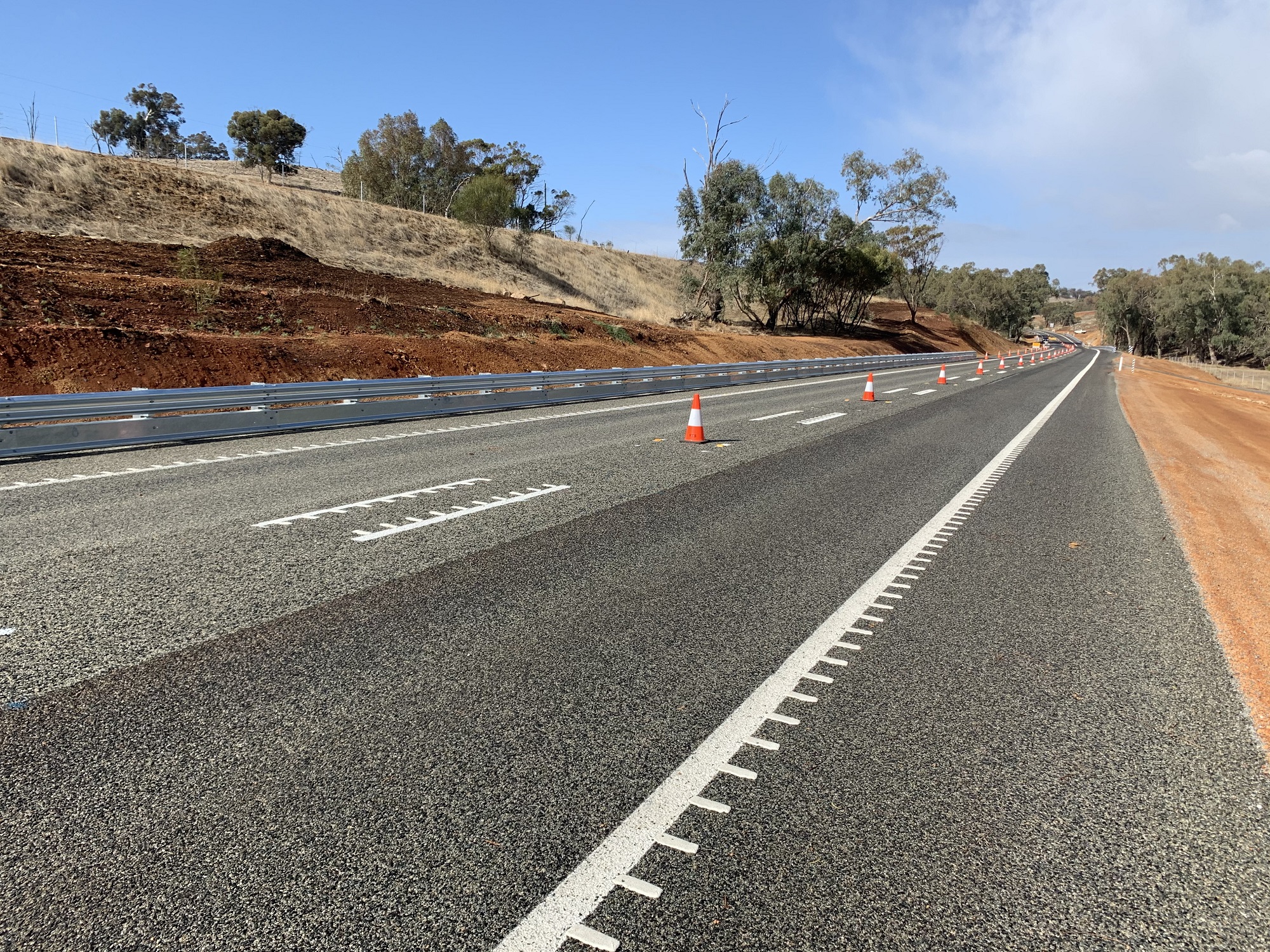
Construction activity on the Toodyay Road Upgrade project well underway, with earthworks and clearing on the eastern sections of the alignment between Dryandra Road and Jingaling Brook Road making good progress. In June, works will get underway in the section of the project between Lovers Lane and Clackline-Toodyay Road. For more information on the progress of the project, please view our latest Construction Update.
Remaining sections to be delivered as a single contract
The Toodyay Road Upgrade project between Dryandra Road and Toodyay was initially divided into six smaller sections. While Sections 3 (Jingaling Brook) and 6 (Clackline-Toodyay Road to Toodyay) have been completed as stand-alone contracts, Main Roads now considers that the amalgamation of the remaining sections of the project into larger packages of works would improve efficiency and reduce the risk of interface challenges between different contractors.
In July 2025, Main Roads released a Tender to Industry for construction of the works between Dryandra Road and Clackline-Toodyay Road. The contract process is nearly complete and announcements expected soon.
Over the next months, significant site works will begin. Further information will be shared with the community once the contract has been finalised and a construction methodology approved.
Works are currently underway to finalise the relocation of electricity, gas and telecommunications services in the vicinity of the site.
The latest Project Update can be found here.
PROJECT RATIONALE AND BENEFITS
Why is this project required?
The Wheatbelt section of Toodyay Road has an unacceptable safety record.
In the decade between 2011 and 2021 there have been 81 crashes, and 30 of these crashes have resulted in death or serious injury. Concerns raised by the community have included the lack of passing lanes, the absence of right turn pockets at key intersections, inadequate intersection design, ageing infrastructure and poor geometry.
While crash numbers have declined in more recent times, the conditions responsible for severity of the earlier crashes (including narrow lanes, limited sight distances, drop-offs and trees) have not changed (with the exception of the two sections of road upgraded as part of this project). With vehicle numbers expected to increase over time, it is likely that other serious incidents will occur in the future.
What are the benefits of the project?
The project will:
- Provide a more forgiving roadside environment, reducing the risk of serious crashes.
- Ease congestion caused by heavy vehicles by improving intersections and providing safe overtaking opportunities
- Improve access to Toodyay and the surrounding Wheatbelt region.
COMMUNITY ENGAGEMENT
Has Main Roads consulted with local stakeholders and the community?
Main Roads has been liaising closely with local community representatives since 2017. This included six Community Reference Group meetings during the design development stage of the project, as well as meetings, briefings and site visits. Project personnel remain available to discuss the project with any interested community members on an ongoing basis.
What changes have been made to the design as a result of community consultation?
Designs evolved over a five-year period and where possible, were been modified to reflect feedback from the local community. The most notable example is the reduction in the project footprint and Sandplain and Salt Valley Roads, where the depth of cut has been reduced by 50% - from 12m in the original design to 6m in the final design. We have also modified the design to avoid a significant number of established trees in this location. Other design changes have included:
- Incorporation of a single span bridge over Jimperding Brook, to retain water flow. A culvert was initially proposed for this location.
- Reconsideration of the design at the intersection of Fernie Road, with a view to retaining a mature wandoo tree, which was previously identified for clearing.
- A reduction in the allowable width for construction machinery to access the site, from 5m down to a maximum of 3m.
- Modifications to the design of the section of road between Dryandra and Morangup Roads to retain a population of sun orchids.
What engagement activity is planned during construction?
As the project moves forward, the Main Roads team is happy to meet with members of the local community on an as-required basis. In addition, more frequent information updates will be distributed to keep the community abreast of the works. If you have any questions or feedback, you are welcome to contact the project team at any time, and we will look to accommodate your requests wherever possible.
DESIGN CONSIDERATIONS
What are the primary design considerations and constraints?
Minimum design standards for new regional roads require 4.5 metre-wide traffic lanes and 1 metre-wide sealed shoulders on each side of the road. This is to provide sufficient lane width for heavy vehicles. In addition, there is a requirement for 3m clearance on each side of the road, to reduce the risk of conflict between road users and vegetation.
Furthermore, the various undulations on Toodyay Road mean some intersections (particularly Sandplain and Salt Valley Roads), suffer from inadequate sight lines. This has necessitated design changes to the geometry in certain locations, requiring minor road realignments and ‘cuts’.
What alternative options were considered?
At the project inception, three options were considered to address the road deficiencies and provide a safe, consistent and efficient driving environment for all road users. The options cover three progressively greater investments to upgrading the road to current standards:
- Option 1 – do nothing (base case)
- Option 2A – seal widening to 8m with minor safety improvements
- Option 2B – seal widening to 8m with minor safety improvements and some intersection upgrades
- Option 3 – seal widening to 11m (x2 4.5 metre-wide traffic lanes and 1 metre-wide sealed shoulders on each side of the road) with significant safety improvements, intersection upgrades and passing lanes
A multi-criteria options analysis and an economic evaluation of each option determined that the greatest value for money is realised by the highest investment option (Option 3), which substantially reduces the incidence and severity of crash rates and provides a 20% increase in travel efficiency.
Why is a 6m ‘cut’ required at the Sandplain and Salt Valley Road intersection?
The Sandplain and Salt Valley Road intersections are located close to the crest of a hill. This results in inadequate sight distances for drivers seeking to access Toodyay Road from both Sandplain Road and Salt Valley Road. The requirement for a cutting in this location is necessary to improve the geometry and increase driver visibility.
Why are five new overtaking lanes required in this 27km section?
One of the major safety risks on regional roads involves light vehicles attempting to overtake heavy vehicles. This is particularly prevalent on single carriageway roads with poor visibility. The incorporation of dedicated passing lanes provides light vehicles with safe overtaking opportunities.
Why can’t the Wheatbelt section of project replicate the section west of Dryandra Road, where a more modest upgrade was undertaken?
The design of our projects is heavily influenced by road conditions, particularly the geometry of the terrain. Because the section west of Dryandra Road generally has a smoother, more forgiving terrain than the section to the east, a relatively modest upgrade was considered appropriate.
The section of the upgrade between Dryandra Road and Toodyay has undulating terrain in many places, resulting in limited sight distances, steep drop offs and few safe overtaking opportunities. The risks posed in this location are evidenced by the poor safety record over the past decade. Providing the necessary safety upgrades in this section require a larger project footprint and some changes to the geometry of the road.
STAGING
How will the project be staged?
The construction program will be delivered over a three-year period. Construction of a 720m section between Clackline-Toodyay Road and Northam-Toodyay Road, adjacent to Coorinja Winery, was completed in May 2023. The remaining sections are being delivered concurrently. Works commenced in April 2026, with completion expected in 2028.
ENVIRONMENT
How much vegetation will need to be cleared?
Over the entire extent of the project, including the sections already constructed, there is approval to clear 54.87 hectares of native vegetation; however, following design refinements, current calculations indicate approximately 48ha requires clearing. We will continue to identify ways to retain as much vegetation as possible as part of our evolving construction methodology.
What plans are in place to revegetate the site?
Main Roads has also developed a revegetation plan contributing to ecological connectivity while preserving the look and feel of the roadside. This includes:
- 52 hectares of revegetation.
- Sourcing 13,800 seedlings (55 species) from six nurseries for revegetation. This included a nursery located on Salt Valley Road.
- Using excess germinated seed to infill plant previous revegetation.
- Translocating 90 grass trees, 50 of which were planted in acquired land adjacent to Jingaling Brook. The remaining 40 grass trees and 20 macrozamia palms kept at a local nursery ready for replanting.
Additionally, 188 artificial black cockatoo nesting hollows are being installed in the reserve or in other nearby nature reserves. The reserve and the nesting hollows will be managed by the Department of Biodiversity, Conservation and Attractions. In December 2021, the first Cockatoo was born in an artificial nesting hollow.
Is an environmental offset in place?
In accordance with State and Federal environmental regulations, an environmental offset for these upgrades includes a property of 196 hectares of prime Wandoo woodland adjacent to the Clackline Nature Reserve. This represents almost an extra one-third of the current reserve. Clackline Nature Reserve will be expanded by around four times the amount of vegetation that will be removed from the road reserve along Toodyay Road. This property will be conserved in perpetuity.
How is water flow being retained in the Jimperding Brook area?
The design of this section of the project incorporates a single span bridge, supported by embankments, which will be revegetated upon completion of construction. The span will allow the brook to flow uninterrupted and has been informed by one in one-hundred-year flood modelling.
FUTURE PLANS
Are changes planned to the heavy vehicle route through the Toodyay townsite?
The current volume of heavy vehicles does not yet warrant a change to the existing HV route through the Toodyay townsite. As a result, no changes or upgrades are funded as part of this project. Also, please be aware that the project itself does not change existing truck volumes or allowable routes; rather it caters for growth in traffic volumes over time.
A series of safety and efficiency improvements will be delivered as part of the project. Upgrades include new overtaking lanes, upgraded intersections and bridge replacements to deliver a safe and consistent journey.
Dryandra Road to Goomalling Toodyay Road (Wheatbelt)
- Road widening.
- Realignment of sections.
- Intersection improvements to include turning lanes.
- Four passing lanes.
- Drainage improvements.
- Replacement of substandard bridges, including the bridge over Jimperding Brook, which is approximately 85 years old.
Dryandra Road to Toodyay
Since 2017, stakeholders and the local community have been engaged regarding the scope and design of the Wheatbelt section. Feedback received from the community has been carefully considered, resulting in various design enhancements to help reduce environmental impacts.
- A significant reduction in the project footprint at the Sandplain and Salt Valley Road intersection. This will enable additional of established vegetation to be retained, including several mature wandoo trees and 85 cockatoo breeding trees.
- Incorporation of a 28 m single span bridge over Jimperding Brook, to retain water flow. A culvert was previously proposed for this location.
- A reduction in the allowable area for heavy machinery to access the site, from 5 m down to 3 m.
- Planting 52 hectares of vegetation along Toodyay Road. Seeds have been collected from the road reserve to ensure the species currently on the roadside are available for revegetation
- Sourcing 13,800 seedlings (approximately 55 species) from six nurseries in the Wheatbelt region for revegetation.
- Use of additional germinated seedlings to infill plant the previous revegetation along the road.
- Translocation of 90 grass trees and 20 macrozamia palms
- Planting 50 grass trees back into land acquired opposite Jingaling Brook
- Bagging 40 grass trees and 20 macrozamia, which are being cared for in a nursery for use when required.
Project information
- Construction Update - June 2026 - PDF (268 KB)
- Fact Sheet - Community and Environment - May 2026 - PDF (318 KB)
- Construction Update - April 2026 - PDF (242 KB)
- Project Update - February 2026 - PDF (123 KB)
- Project Update - July 2025 - PDF (264 KB)
- Construction Update - January 2023 - PDF (132 KB)
- Construction Update - December 2022 - PDF (302 KB)
- Construction Update - November 2022 - PDF (257 KB)
- FAQ's - PDF (165 KB)
- Project Update - September 2022 - PDF (1.59 MB)
- Fact Sheet - Aspen Road to Dryandra Road - March 2021 PDF (867 KB)
- Project Update - November 2020 - PDF (872 KB)
- Project Update - January 2019 - PDF (826 KB)
Funding
Dryandra Road to Goomalling Toodyay Road (Wheatbelt)
This $80 million project is jointly funded by the Australian and Western Australian Governments.
safety
overtaking opportunities
journeys